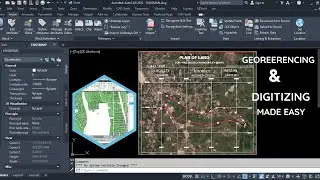
How to Georeference and Digitize Maps in AutoCAD - EASY Guide
You won't believe how simple it is to georeference and digitize maps in AutoCAD. — I'm going to show you the easiest way to do it!
In this comprehensive and easy-to-follow guide, we will explore the essential steps to georeference and digitize maps using AutoCAD. Whether you are a beginner or an experienced user, this tutorial will provide you with valuable insights and techniques to enhance your mapping projects.
Learn how to:
Understand georeferencing concepts and importance
Prepare your maps for digitization
Use AutoCAD tools effectively for accurate georeferencing
Create and edit vector data from raster maps
Save and export your digitized maps for various applications
By the end of this video, you'll have the skills needed to effectively georeference and digitize maps in AutoCAD, making your workflow more efficient and precise.
0:00 Introduction
0:35 Georeferencing
1:05 Plotting Ground Points
1:43 Importing File
2::12 Assigning Layer to File
2:41 Process
4:00 Checking Georeferencing Accuracy
4:25 Digitizing Georeferenced File
5:30 Previewing Digitized File
5:57 Conclusion
Don't forget to subscribe for more helpful tutorials and tips on CAD software! #AutoCAD #Georeferencing #DigitizingMaps #MappingTutorial #CADGuide
Auf dieser Seite können Sie das Online-Video How to Georeference and Digitize Maps in AutoCAD - EASY Guide mit der Dauer stunde minuten sekunde in guter Qualität ansehen, das der Benutzer Nexxis Tutorials 14 August 2024 hochgeladen hat, den Link mit Freunden und Bekannten teilen, dieses Video wurde auf Youtube bereits 20,774 Mal angesehen und es wurde von 245 den Zuschauern gefallen. Viel Spaß beim Betrachtenden Zuschauern gefallen!