Image Classification in ArcGIS (Supervised) | Landsat Image
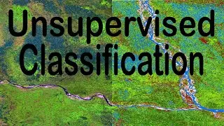
A Landsat 8 Image can be classified according to the corresponding land use in ArcGIS very easily.
In this video, Supervised Image Classification Process is explained in the simplest way.
#landsat #imageclassification #arcgis #imageclasses #supervisedclassification
_____________________________________________________________________
Channel Intro: • GIS (Geographic Information Systems) | The...
NDMI: • NDMI in ArcGIS | Moisture Index Map in ArcGIS
Area from Classified Image: • Area Calculation from Image in ArcGIS | Ve...
NDVI: • NDVI in ArcGIS | Vegetation Map in ArcGIS
BSI (Bare Soil Index) Calculation: • Stream Order Map from DEM in Model Builder...
Area and Perimeter in ArcGIS: • Calculate Area and Perimeter of Polygons i...
Digitizing in Google Earth Pro: • Digitizing in Google Earth Pro in 5 Minute...
Zonal Statistics in ArcGIS: • ZONAL STATISTICS in ArcGIS
Interpolation in ArcGIS: • INTERPOLATION by KRIGING in ArcGIS | Map C...
Digitizing in ArcGIS: • Zero to Hero of Digitizing in ArcMap | Geo...
Georeferencing for Beginners: • Georeferencing Downloaded Image (Map) in A...
Georeferencing from Google Earth Image: • Georeference and Project Image in ArcGIS |...
Playlist of Beginner Guide to GIS: http://bit.ly/48Y0Gxw
Subscribe to the Channel: / @geosciencelab
_____________________________________________________________________
This playlist on the applications of ArcMap (ArcGIS Software) will enrich your basic and practical knowledge on Geographic Information Systems (GIS).
_____________________________________________________________________
Free Asset: https://bit.ly/3N8KIr8
_____________________________________________________________________
I will sequentially upload videos on numerous ArcGIS applications so that you can master on Geospatial Analysis.
_____________________________________________________________________
Related Tags: image classification, landsat image classification, landsat 8 image, land use classification, image classification in arcmap, image analysis, image classify, landsat supervised classification, supervised classification in arcmap, how to do supervised classification in arcgis, how to do landsat 8 image classification, easy arcgis tutorial, arcgis attribute table, arc gis desktop, joining data to shapefile, arcgis raster, esri, arcgis topographic maps, GIS, Geographic Information System, Muhammad Al Amin, Geospatial Navigators
En esta página del sitio puede ver el video en línea Image Classification in ArcGIS (Supervised) | Landsat Image de Duración hora minuto segunda en buena calidad , que subió el usuario GeoScience Lab 02 diciembre 2023, comparta el enlace con amigos y conocidos, en youtube este video ya ha sido visto 10,438 veces y le gustó 203 a los espectadores. Disfruta viendo!