SpatialAPI20: Teaser for Tutorial 2: Cloud-based Deep Learning on AWS from Satellite Data and LiDAR
Github Link: https://github.com/aws-samples/aws-op...
By: Yunzhi Shi, Xin Chen, Tianyu Zhang (Amazon Web Services)
Abstract:
There is a large amount of public open data hosted in the AWS Open Data Registry. The datasets range from genomics to climate to transportation information. They are well structured and easily accessible. However, there are few examples of how to leverage the datasets in machine learning (ML) model development in the cloud.
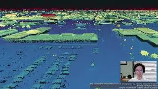
We create this tutorial by developing Jupyter notebooks to train and test deep learning models using AWS SageMaker to extract building footprints and road networks from satellite imagery and LiDAR data in the registry. The notebooks reproduce winning algorithms from the SpaceNet challenges. In addition to the SpaceNet satellite images, we compare and combine USGS 3D Elevation Program (3DEP) LiDAR data to extract the same and our results outperform some of the top winning teams’.
We will share the notebooks and provide hands-on step-by-step instructions for running ML services on AWS to extract features from large scale geospatial data in the cloud. Through the tutorial, the audience will be able to train the building and road extraction models on AWS, apply the models to other regions where satellite or LiDAR data are available, and experiment with new ideas to improve the performances. The audience will experience the benefits of cloud computing and storage first-hand.
En esta página del sitio puede ver el video en línea SpatialAPI20: Teaser for Tutorial 2: Cloud-based Deep Learning on AWS from Satellite Data and LiDAR de Duración hora minuto segunda en buena calidad , que subió el usuario Ahmed Eldawy 29 octubre 2020, comparta el enlace con amigos y conocidos, en youtube este video ya ha sido visto 233 veces y le gustó 3 a los espectadores. Disfruta viendo!