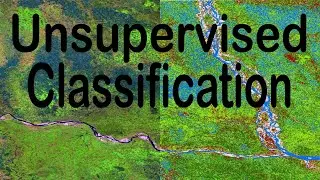
Image Classification in ArcGIS (Unsupervised) | Landsat 8 and 9 Image
A Landsat 8 and 9 Satellite Images can be easily and automatically classified according to the corresponding land use in ArcGIS very easily.
In this video, Unsupervised Image Classification Process is explained in the simplest way.
#landsat #imageclassification #arcgis #imageclasses #unsupervisedclassification #remotesensing #remosensingtechniques
_____________________________________________________________________
Geodatabase Design: • Geodatabase Designing in ArcGIS for Beginn...
Supervised Image Classification: • Image Classification in ArcGIS (Supervised...
Channel Intro: • GIS (Geographic Information Systems) | The...
NDMI: • NDMI in ArcGIS | Moisture Index Map in ArcGIS
Area from Classified Image: • Area Calculation from Image in ArcGIS | Ve...
NDVI: • NDVI in ArcGIS | Vegetation Map in ArcGIS
BSI (Bare Soil Index) Calculation: • Stream Order Map from DEM in Model Builder...
Area and Perimeter in ArcGIS: • Calculate Area and Perimeter of Polygons i...
Digitizing in Google Earth Pro: • Digitizing in Google Earth Pro in 5 Minute...
Zonal Statistics in ArcGIS: • ZONAL STATISTICS in ArcGIS
Interpolation in ArcGIS: • INTERPOLATION by KRIGING in ArcGIS | Map C...
Digitizing in ArcGIS: • Zero to Hero of Digitizing in ArcMap | Geo...
Georeferencing for Beginners: • Georeferencing Downloaded Image (Map) in A...
Georeferencing from Google Earth Image: • Georeference and Project Image in ArcGIS |...
Playlist of Beginner Guide to GIS: http://bit.ly/48Y0Gxw
Subscribe to the Channel: / @geosciencelab
_____________________________________________________________________
This playlist on the applications of ArcMap (ArcGIS Software) will enrich your basic and practical knowledge on Geographic Information Systems (GIS).
_____________________________________________________________________
Free Materials:
_____________________________________________________________________
I will sequentially upload videos on numerous ArcGIS applications so that you can master on Geospatial Analysis.
_____________________________________________________________________
Related Tags: image classification, remote sensing, landsat image classification, landsat 8 image, landsat 9 image, land use classification, image classification in arcmap, image analysis, image classify, landsat unsupervised classification, unsupervised classification in arcmap, how to do unsupervised classification in arcgis, how to do landsat 8 and 9 image classification, easy arcgis tutorial, arcgis attribute table, arcgis desktop, joining data to shapefile, arcgis raster, esri, arcgis topographic maps, GIS, Geographic Information System, Muhammad Al Amin, Geospatial Navigators
In questa pagina del sito puoi guardare il video online Image Classification in ArcGIS (Unsupervised) | Landsat 8 and 9 Image della durata di ore minuti seconda in buona qualità , che l'utente ha caricato GeoScience Lab 01 gennaio 2024, condividi il link con amici e conoscenti, su youtube questo video è già stato visto 3,522 volte e gli è piaciuto 78 spettatori. Buona visione!