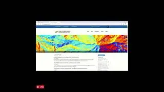
DTM Data Downloads in ArcGIS Pro
Downloading Digital Terrain Model (DTM) data from the OpenTopography API based on specified geographic locations or bounding boxes.
✅ Code algorithm:
Retrieve DTM Data: Utilize the OpenTopography API to fetch DTM data.
Process Feature Bounds: Transform feature bounds to a Polygon object for API requests.
Download and Save DTM Files: Save fetched DTM data to your specified output folder
🔧 Requirements:
Python 3.x
Packages: requests, geopandas, os
An API code obtained from OpenTopography. Don't have one? 😲 Sign up for free on their website to get it! 🤗
🔗 OpenTopography website
https://lnkd.in/dHQ69yQY
📂 GitHub Repository Files:
OpenTopo-DTM-Downloader.py: Main Python script file.
README.md: Instructions on usage and requirements.
how_to_run_the_code.mp4: Video demonstrating how to run the code.
🔗 GitHub Repository Link:
https://bit.ly/43CsvsV
Thanks and credit to Mohamed Mokashifi
Thanks for watching it.
Please like, share, and subscribe to this channel.
YouTube: / 7startech95
Facebook: / 7startech95
Instagram: / 7startech95
Twitter: / 7startech95
Blog: https://www.7startech95.blogspot.com
LinkedIn: / 7startech95
Contact us at:
[email protected]
#gis #arcgispro #dtm #opentopography #7startech95 #shorts #short #shortvideo #shortsvideo
Auf dieser Seite können Sie das Online-Video DTM Data Downloads in ArcGIS Pro mit der Dauer stunde minuten sekunde in guter Qualität ansehen, das der Benutzer 7StarTech 30 März 2024 hochgeladen hat, den Link mit Freunden und Bekannten teilen, dieses Video wurde auf Youtube bereits 279 Mal angesehen und es wurde von 5 den Zuschauern gefallen. Viel Spaß beim Betrachtenden Zuschauern gefallen!